|
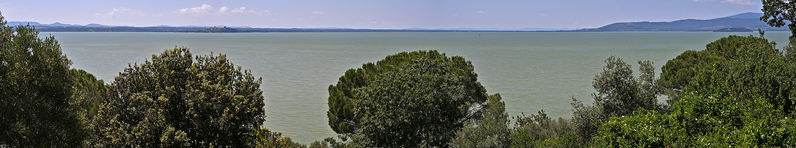
Polvese Island is the largest of the three in Lake Trasimeno.
It covers an area of 69,6 hectares. Its shoreline is 258 meters above sea level, while its summit reaches 313,4 meters. The eastern and southern parts contain a vast wetland with reed beds that provide shelter to various species of birds and amphibians.
Administratively, the island is a hamlet of the municipality of Castiglione del Lago, and in 1995 the province declared it a scientific-educational park within the Trasimeno Regional Park. It has a pier used for ferry services, primarily to nearby San Feliciano.
The monastery of San Secondo (10th-14th century) sits at the summit of the island. Only the external walls remain of this Romanesque complex with three naves, a crypt, and an apse, originally occupied by Olivetan monks.
https://de.wikipedia.org/wiki/Isola_Polvese
|
 |


Comments
Cheers, Hans-Jörg
I think you well understand the area (a lake in central Italy), but not the trigger point ;-)
when I opened this panorama last week, I immediately thought that it had been triggered by my comment on your panorama of the Torre Comunale (#31378), which Id written during my vacations shortly after visiting the tower. Regarding the point 1.148m, I thought it might be Monte Cetona, which I also saw from Pienza ... and to the right of C.d.L. that must be the Amiata!? But, as is often the case, I may be mistaken; it is undeniably your territory ;-) !!
Cheers, Hans-Jörg
Monte Amiata isn't visible in this panorama. It's further to the left. And Monte Cetona is even further to the left.
The shooting point for this panorama is very unusual, and you have to take the boat ;-)
Leave a comment