
|
|||||
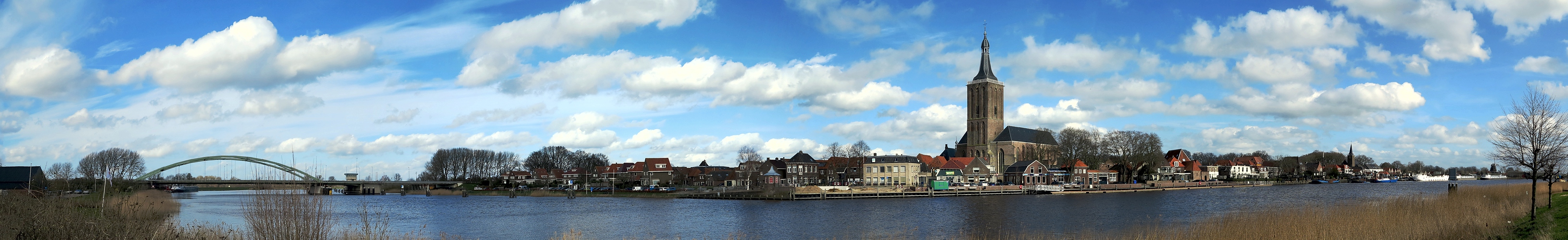
City front Hansecity of Hasselt (with high water)
The Hansecity of Hasselt (like Kampen) also suffers from the high water levels of the Zwarte Water. Normal height of the bridge is 7 to 8 meters, in this photo 4 to 5 meters. So here the water is more than three meters higher than normal (not clearly visible on photo) and it is still rising, why is that? The Zwarte Water is fed with (rain) water from various water sources from Salland and the wider area. At Genne* the water of the Overijsselse Vecht is added, after which the river flows into the IJsselmeer via the Zwarte Meer and Ketelmeer. The Overijsselse Vecht (Lower Saxon: De Vechte) is a rainwater river in Germany and the Netherlands. *) See Panorama: Zwolsedijk (360 °) Hasselt, March 2018. Camera Canon G1 X, 28 mm KB, 6 shots KB landscape. |
||||||||||||||||
|
|||||||


Comments
Leave a comment