A REAL Åland pano   21836
vorheriges Panorama
nächstes Panorama
Details / LegendeDetails / Legende Marker ein / ausMarker ein / aus Übersicht ein / ausÜbersicht ein / aus   
 Durchlauf:   zum ersten Punkt zum vorherigen Punkt Durchlauf abbrechen
Durchlauf starten
Durchlauf anhalten
zum nächsten Punkt zum letzten Punkt
  verkleinern
 

Legende

1 Gärsbäckfladan
2 Silverskär
3 Tistronören
4 Gaasören

Details

Aufnahmestandort: Orrdalsklint (129 m)      Fotografiert von: Geir Anders Langangen
Gebiet: Åland Islands      Datum: 26.06.2019
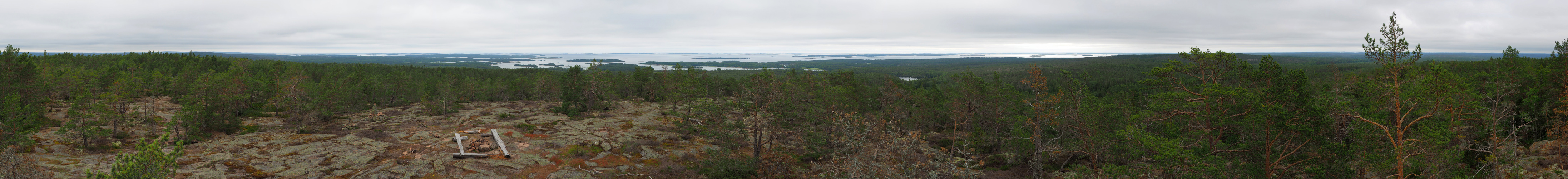
Her comes a genuine panorama from Åland, unlike the "fake" one placed here. The question is: Wouldn't it be better with a separate category (not country) for tests and quizes?

Åland is an autonomous archipelago (a region of Finland) located between Sweden and Finland. The majority of the population is Swedish.

The archipelago is relatively flat. The Orrdalsklint, beeing only 129 meters above sea level, is the highest point in Åland.

Location:
https://www.openstreetmap.org/?mlat=60.32815&mlon=20.12115#map=10/60.1985/20.2011

Kommentare

Endless no-man's-land - next panorama at a distance of 77 kilometers, there is still much to do, Geir ;-) !!!

Cheers, Hans-Jörg
14.08.2019 07:01 , Hans-Jörg Bäuerle
Impressive view. And thanks to the inhabitants for hosting many of our riddles ;-) Cheers, Martin
15.08.2019 19:57 , Martin Kraus

Kommentar schreiben


Geir Anders Langangen

Weitere Panoramen

... in der Umgebung  
... aus den Top 100