|
This pano is intended to further document the horizon features one can observe from the Waterfront tower. In November last year, very clear air in the direction of Ghent allowed me not only to distinguish many buildings of the city but also the most northerly hills of a hilly region called: the Flemish Ardennes. Roughly between Ghent, Brussels and Renaix, this hilly region is well know by cyclist enthousiasts because Belgium's most famous cycling race: "de Ronde van Vlaanderen" (Tour de Flanders) is mainly held there.
What I clearly could determine from Waterfront are: the Balei hill (83 m TAW), with watertower, just south of Sint-Lievens-Houtem and the Betsberg (65 m TAW), just southeast of Ghent. These hills are at a distance of respectively 47.3 km and 42.2 km from here. As such the Balei hill is the *farthest natural geographical object * I was able to distinguish with certainty from Waterfront. Inbetween both hills there are a few other hills which I think are the Balegemberg (72 m at 46.3 km) and a hill near the village of Oombergen (75 m at 47- 48 km) but I am not a 100% sure this correct.
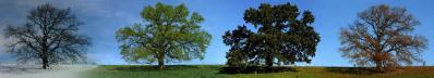
I would like to point out that these hills are largely covered with forest trees of about 15 - 20 m height and these make the tops we see.
The pano starts, at left, with the city of Sint-Niklaas (at 30 km) on the horizon. A bit more to the right, another elevation in Flanders can be seen and known as: "the Cuesta of Waasmunster". The highway E17 between Ghent and Antwerp cuts through it near Waasmunster. The cuesta is 32 m high (TAW) and its formation has to do with the Rupel Clay, a Teriary compact clay layer from the Oligocene period (23-34 million years ago).
Heights in Belgium are referenced to TAW with 'zero' level 2.33 m below NAP in Holland and Scandinavian countries. I have also determined the exact height of the camera: 66.01 m NAP or 68.34 m TAW.
This pano is the wider 150 mm (240 mm KB) view with only 5 % crop. To show the details better I will publish next a 55 % cropped version and of course with all the names of the buildings in Ghent.
Canon Eos M6 with EF-M 18-150 mm, 21 pics JPEG, 150 mm (240 mm kb) iso 125, f6.3, 1/200 s, PTGuiPro, 30000x1761 212.9 MB TIFF, crop 5%, downsized 8472x500 1.8MB JPEG
Jörg Braukmann, Hans-Jörg Bäuerle, Walter Huber, Heinz Höra, Franz Kerscher, Martin Kraus, Giuseppe Marzulli, Steffen Minack, Jan Lindgaard Rasmussen, Danko Rihter, Silas S, Werner Schelberger, Björn Sothmann, Jens Vischer
|
 |


Comments
So how can I introduce the coordinates in a pano and get something to 1/10 of a degree?
Mentor, in the pano you can not, of course, the coordinates, but you use the calculated direction angle.
In my opinion, UDeuschle is not suitable for this. If UDeuschle is to bring something, then there must be contours that you can click on, where the position is displayed in Google maps...
PS: Mentor, UDeuschle would be of use to you if you put in the coordinates of the objects in question with a name at http://www.geonames.org/. This takes over UDeuschle within a few days and then shows it in its calculated view - if it is visible from the entered observation point.
https://www.udeuschle.de/panoramas/panqueryfull.aspx?mode=newstandard&data=lon%3A3.83418%24%24%24lat%3A51.33833%24%24%24alt%3Aauto%24%24%24altcam%3A70%24%24%24hialt%3Afalse%24%24%24resolution%3A40%24%24%24azimut%3A175%24%24%24sweep%3A100%24%24%24leftbound%3A125%24%24%24rightbound%3A225%24%24%24split%3A30%24%24%24splitnr%3A4%24%24%24tilt%3A-1.77083333333333%24%24%24tiltsplit%3Afalse%24%24%24elexagg%3A1.2%24%24%24range%3A300_grid%24%24%24colorcoding%3Afalse%24%24%24colorcodinglimit%3A23%24%24%24title%3ATerneuzen-Niederlande%24%24%24description%3A%24%24%24email%3A%24%24%24language%3Age%24%24%24screenwidth%3A1536%24%24%24screenheight%3A864
What are you going to do with it? There is only one object that is called. You can only click on a few points and a Google map will appear in the middle of which the coordinate is calculated from the distance and altitude. This is the opposite way to what I have described. You didn't win that.
The UDeuschle pano looks indeed flat with tiny unspecified elevations on the horizon. However with the telescope function we can see them better. I compare the telescope view (direction, height,distance, shape) with a 2.5 m contour lines topographic map and with my heavily cropped pano. If I recognise on my pano in the same direction a similar height, it is likely the same. However, the contours seen on the pano are mostly from the vegetation. So I also try to find recognizable things like big antennas and certain constructions (checked with street view) from which I verify the direction and distance to Waterfront with this tool:https://www.looptijden.nl/route/afstandmeten. Additionally, I check these directions with well recognizable features (buildings) along their paths to be sure there is accordance with my pano. If all these things match, I think the answer is quite certain although I really detect inaccuracies using the Google satellite maps.
So now I am already certain that the highest hill of the Flemish Ardennes, at a record distance of 64.5 km, is visible on this pano which soon I will show with the heavily cropped version.
Leave a comment